Natural Atlas: Trail Map & GPS
- 3.8
- Rating
- 10.00K
- Installs
- Free
- Price

 Analysis by App-foxy
I usually know within a few outings whether a navigation app is going to become part of my routine or remain an interesting download. Natural Atlas: Trail Map & GPS made a good first impression because it brings together trail-oriented mapping and outdoor reference material instead of treating a hike like a simple point-to-point drive. It is a free Android app in the Maps & Navigation category, developed by Natural Atlas, and its focus is clearly people who spend time walking beyond ordinary streets.
That focus matters. A general map app can get me to a trailhead, but it often makes the actual walk feel like an afterthought. Natural Atlas feels more purposeful when I am thinking about route choice, terrain, and what I may encounter outside the city. I would not call it an automatic replacement for every navigation tool, though. Its value depends on how often you hike, how much preparation you are willing to do, and whether you need a polished all-purpose map or a more outdoors-centered companion.
Why the first week feels useful
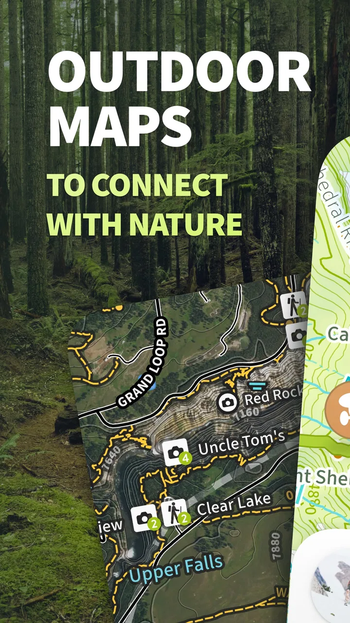
During the first few sessions, the appeal comes from the app’s narrow purpose. I can open it with a hike in mind rather than translate a driving map into an outdoor plan. The combination of topo maps, trail information, and a field-guide approach gives the experience a different rhythm from checking a route in a mainstream mapping app. Instead of only asking, “How do I get there?”, I am encouraged to think about the character of the place and the route itself.
You May Also Like

 Pandora - Music & Podcasts
Pandora’s Music Is Easy to Start, but Harder to Recover
Pandora’s strength is its low-effort path from a seed to a station. Its weak spot is how much confidence it asks you to place in connection, setup, and quiet recovery.

 AccuWeather: Weather Radar
AccuWeather Review: A Quick, Clear Forecast for Everyday Decisions
For everyday plans, the best forecast is the one you can understand quickly. AccuWeather makes rain timing, radar, and local conditions easy to act on, with a few trade-offs.

 Hill Climb Racing
Why Hill Climb Racing Still Turns Crashes Into One More Run
A tiny car, a bumpy hill and one more upgrade: Hill Climb Racing keeps resurfacing because its simple chaos makes every near-miss feel personal.

 AliExpress - Shopping App
AliExpress Makes Global Shopping Feel Personal, but Shoppers Bear the Risk
AliExpress turns a global marketplace into a pocket-sized discovery engine. Its reach is useful, its shopping loop compelling, and its trade-offs easy to miss.

 Lords Mobile: Kingdom Wars
Lords Mobile Is a Kingdom-Building Routine, Not a Quick Match
A case-by-case verdict on the building, battles, device demands, and social commitments that make Lords Mobile rewarding for some players and exhausting for others.

 PDF Scanner app - TapScanner
TapScanner Makes Paperwork Easier to Capture, Check, and Share
TapScanner makes scanning with a phone feel less like a rescue operation and more like a dependable step in getting work done. Its capture tools are useful, though not flawless.
More From Our News Desk
View All News


That makes it especially handy during the planning stage. Before leaving, I can look at the intended area, consider how the trail sits within the surrounding landscape, and decide whether the outing matches my energy and experience. This is a small but important distinction: the app is not only useful when I am already lost or uncertain. It can help me make a better choice before I put on my boots.
The topo-map angle is also more meaningful on foot than a standard road view. Contours and terrain context can change how I read a route. A line that looks short on a basic map may involve a climb that I would rather know about in advance. I still treat any digital map as one source of judgment rather than a guarantee, but the outdoor presentation encourages more realistic preparation than a simple street map does.
One of my favorite early uses is planning a short walk that could easily become longer. I can start with a known trail, inspect nearby options, and keep a backup idea ready without opening several unrelated apps. That is useful for a weekend morning when I do not want a complicated expedition but still want to avoid wandering without a plan.
The field-guide side adds another layer to the first-week experience. It makes the app feel less like a blinking location dot and more like a companion for paying attention to the environment. I would not install it solely for that aspect, but it gives the product a stronger identity than another generic GPS screen. For someone who enjoys learning what is around the trail, that extra context can turn a routine walk into a more deliberate outing.
New users should spend time learning how the map behaves before relying on it in an unfamiliar area. Outdoor navigation is not the place to discover basic controls halfway through a hike. I recommend opening the app at home, searching around a familiar park, checking how routes and map details are presented, and practicing the gestures you expect to use outdoors. That preparation is more valuable than assuming the app will be self-explanatory at the trailhead.
The free entry point makes that trial easier. I can explore the basic experience without committing money immediately, then decide whether the more advanced parts justify further spending. The app is marked for Teen audiences, and its current version is 4.7.1, so it presents itself as an actively maintained product rather than an abandoned experiment. Its average rating is 3.8 from around a hundred ratings, which feels like a reasonable signal to investigate rather than a reason to accept or reject it blindly.
Where it fits beside ordinary map apps
I would use a familiar general-purpose map when I need traffic, business details, driving directions, or a quick way to reach a meeting point. Natural Atlas makes more sense after the pavement becomes less important. Its advantage is not that it does every kind of mapping better; it is that the outdoor use case is placed at the center.
That difference creates a practical two-app workflow for many people. I might use a regular map to navigate to the parking area, then switch to Natural Atlas for the walk itself. This avoids forcing one app to handle tasks it was not designed to prioritize. It also gives me a backup if the trail app is not the best option for the road portion of the trip.
Compared with a dedicated hiking service, the decision is more personal. Someone who mainly wants community route sharing, social activity feeds, or a large collection of user-created outings may prefer a service built around those habits. Natural Atlas is more attractive to me when I want a quieter, map-first experience with field-guide character. The trade-off is that its appeal may feel less immediate if my main goal is simply to follow the most popular route other people have already recorded.
What remains valuable after the novelty
The first week is easy to enjoy because every map feels new and every nearby trail suggests a possibility. The harder test is whether I still open the app after that curiosity fades. In my experience, the lasting value comes from using it as a repeatable planning tool rather than treating it as a one-time trail browser.
For regular walkers, that repeatability can be worthwhile. I can return to the same region in different seasons, compare a familiar outing with a nearby alternative, and make a more informed decision about how ambitious the day should be. The app becomes useful not because one feature dazzles me, but because it reduces the friction between “I want to hike” and “I know which hike fits today.”
A good monthly habit would be to review upcoming outings before the weekend, save a simple plan mentally or through the app’s available workflow, and check the area again if conditions or goals change. I would not rely on memory alone for a route I have not walked recently. A trail that felt easy on a cool morning can feel very different when I am carrying more gear or dealing with poor visibility.
The field-guide material can also create recurring value for families and curious hikers. A child or teenager may be more interested in identifying what is around the path than studying a map screen. That makes the app a better fit for exploratory walks than a navigation tool that only tells me where I am. Still, I would keep the educational element connected to the outing rather than expect it to replace a dedicated reference library.
Another long-term strength is the way the app can support route judgment. I find it most useful when I use the map to ask questions: Is this loop realistic for the available time? Does the terrain suggest a slower pace? Is there an easier alternative nearby? Those questions are more valuable than obsessing over a perfect line. The app helps with preparation, but my own decisions still matter.
There is also a useful distinction between familiar and unfamiliar terrain. On a local trail, Natural Atlas can help me vary my routine without making the outing feel risky or complicated. In a new area, it can give me a better starting picture, but I become more cautious about treating the screen as complete authority. I would pair it with sensible preparation, especially when the route is remote or the weather is changing.
When the paid side may make sense
The app is free to install, but in-app purchases are listed at $39.99 per item. That is not an impulse purchase for most hikers, so I would approach it as a decision about recurring use rather than a casual upgrade. The right question is not whether the paid option sounds attractive on the first day; it is whether I will use the relevant capabilities often enough to justify the cost over a season.
I would first test the free experience on the kinds of walks I actually take. If I only hike a couple of times a year, the free version may be enough for planning and basic exploration, and a paid purchase could feel excessive. If I regularly visit unfamiliar areas and the upgraded tools remove a repeated obstacle in my preparation, the calculation changes. The value is personal because the purchase has to solve a problem I encounter repeatedly.
Before paying, I would also check exactly what the selected purchase unlocks and whether it suits my phone habits. A feature that looks important in a store description may not matter to someone who mostly hikes familiar local routes. This is one area where patience helps: use the app through several outings, note what frustrates you, and only then decide whether the purchase addresses that frustration.
The maintenance burden of keeping it useful
Every navigation app creates some maintenance, and outdoor tools deserve more attention than casual entertainment apps. I would not wait until I am standing at a trailhead to discover that I need to adjust settings, review a map area, or understand a new interface. A short check before each unfamiliar outing is part of using Natural Atlas responsibly.
The burden is manageable when the app becomes part of a routine. I can inspect the route at home, confirm that I understand the intended path, and make sure my phone is ready for a day outside. That preparation may sound obvious, but it is exactly what separates a useful navigation companion from a last-minute rescue plan.
Version changes can affect habits too. The current release is 4.7.1, and regular users should be prepared for controls or presentation to evolve over time. I do not consider that a major flaw, but it means I would recheck important workflows after an update rather than assume everything works exactly as before. An app that becomes part of outdoor safety deserves that small amount of attention.
I also prefer to treat the phone as one part of my kit. Battery management, weather awareness, and a backup plan remain my responsibility. Natural Atlas can help me interpret a route, but it cannot remove the consequences of poor preparation. That is a genuine limitation of app-based navigation generally, and it is especially important when a trail moves beyond reliable everyday connectivity or quick access to help.
My practical maintenance routine would be simple: review the route before leaving, avoid depending on a single screen for every decision, and revisit the app after an outing if the experience exposed a confusing step. That last point is useful because friction is easier to solve at home than on a slope. If I repeatedly struggle with the same task, I would either change my workflow or admit that another navigation product fits me better.
What can cause fatigue over time
The biggest source of fatigue is the gap between the promise of outdoor discovery and the discipline required to use digital navigation well. At first, browsing maps feels like planning. After several outings, repeated checking can start to feel like administration, especially for a short walk I already know. If the app does not save me time or improve my decisions, I will naturally return to simpler habits.
There is also a risk of overthinking the map. Topographic detail is helpful, but more information does not automatically produce a better hike. I can spend too long comparing routes, studying contours, and searching for the ideal outing when a straightforward local loop would have been enough. My solution is to set a planning limit: choose a realistic route, identify the important uncertainties, and stop once I have enough information to act.
The field-guide approach may not appeal to every hiker either. Some people want to move efficiently and keep their phone away. For them, extra context can feel like distraction rather than enrichment. I enjoy having that option, but I would not force it into every outing. Natural Atlas works best when curiosity is part of the reason I am outside.
Another limitation is that the app’s value may vary sharply by location and personal expectations. A user who expects the same depth and convenience everywhere could become disappointed if a familiar regional workflow does not translate perfectly to a new destination. I would test it locally before making it the only tool for a major trip. That trial tells me more than a rating or a short description can.
The rating of 3.8 suggests a mixed but not disastrous reception, and I think that matches the product’s position. It is specific enough to be useful to the right person, yet not so universal that every map user will immediately prefer it. With around ten thousand installs, it also feels more like a focused outdoor app than a dominant mainstream platform. That is not automatically negative; smaller reach can coexist with a better fit for a particular habit.
I would skip it if my outdoor needs are limited to driving directions, city walking, or finding nearby businesses. I would also look elsewhere if my priority is a highly social hiking network, extensive group coordination, or a tool centered on sharing every activity. Natural Atlas is a stronger candidate for independent planning and trail-minded exploration than for turning hiking into a social timeline.
My long-term verdict for different kinds of hikers
After the novelty fades, I think Natural Atlas earns lasting space for people who hike often enough to benefit from deliberate route planning and who enjoy understanding the landscape around them. Its strongest quality is its point of view: it treats hiking as more than following a line from one location to another. The topo-map and field-guide combination gives my outdoor planning more substance than a standard map app usually provides.
I would recommend starting with modest expectations. Install it, try it on a familiar trail, and learn the workflow before trusting it on an unfamiliar route. Use a normal map for the journey to the trailhead when that is more convenient, then let Natural Atlas handle the outdoor-focused part. This split approach is often more practical than demanding that one app do everything.
I would also delay the $39.99-per-item purchase until I can name the repeated problem it solves. If the free experience already supports my local walks, paying may not add enough value. If I keep returning to the app, explore new areas regularly, and find that the upgraded capabilities improve preparation, the cost becomes easier to evaluate as a long-term tool rather than a novelty expense.
For me, the app’s recurring value depends on habit. It rewards a user who plans before leaving, checks routes with a critical eye, and treats digital guidance as support rather than absolute truth. It becomes less compelling for someone who wants instant simplicity or never hikes beyond well-known paths. That is a fair trade-off, not a defect: a focused tool does not need to serve every kind of map user.
Natural Atlas is free, aimed at Teen users, and compatible with Android 5.0 and later, which keeps the starting barrier low for many people. I see it as a thoughtful companion for hikers who want maps and environmental context in the same place, with enough flexibility to support repeated outings. Its lasting strength is not novelty but the way it can turn route planning into a dependable pre-hike habit. If that habit matches how you spend time outdoors, I think it is worth trying. If you only need basic directions or prefer a social trail platform, another option will probably earn more space on your phone.
FAQs for Natural Atlas: Trail Map & GPS
01What is Natural Atlas: Trail Map & GPS used for?
Natural Atlas: Trail Map & GPS is designed for exploring trails and outdoor areas with map-based navigation tools. It can help hikers, campers, runners, anglers, and other outdoor users discover routes, view terrain information, and plan trips. The app is especially useful when you want a clearer overview of natural areas before heading outside, although available information may vary by location.
02Does Natural Atlas: Trail Map & GPS work without an internet connection?
Offline functionality is an important consideration for any trail-navigation app, particularly in remote areas with weak or unavailable mobile service. Natural Atlas may provide access to saved or downloaded map information, depending on the current version and subscription features. Before leaving, users should download the necessary maps, confirm that they are available offline, and avoid relying on the app as their only source of navigation.
03Is Natural Atlas: Trail Map & GPS free to download and use?
The application may be available to download at no initial cost, but some advanced features, map resources, or outdoor content can require in-app purchases or a subscription. The exact pricing and included tools can change over time and may differ between Android and iOS. It is worth checking the store listing carefully before downloading, especially if you need offline maps or premium navigation features.
04How accurate are the maps and GPS directions in Natural Atlas?
The app uses your device’s GPS and map data to help show your position and support outdoor navigation. Accuracy can be affected by tree cover, steep terrain, weather, battery-saving settings, and the quality of local map information. Trail conditions and routes can also change after an update. For safety, compare the app with posted signs, official park information, and a physical backup map when exploring unfamiliar areas.
05Is Natural Atlas suitable for beginners and experienced outdoor users?
Natural Atlas can be useful for both beginners and experienced explorers because it combines map viewing with tools for planning and understanding outdoor routes. Beginners should spend time learning the interface, saving important locations, and checking the route before starting. Experienced users may appreciate having digital trail information in one place, but should still verify access rules, closures, weather conditions, and local regulations before each trip.
Pros
- Detailed trail maps with useful terrain and route information.
- Offline map downloads help when hiking beyond cellular coverage.
- GPS tracking makes it easy to monitor your position and progress.
- Supports planning custom routes for hikes
- runs
- and outdoor trips.
- Community content can reveal lesser-known trails and local destinations.
Cons
- Some advanced maps and features require a paid subscription.
- Battery usage can increase noticeably during continuous GPS tracking.
- Trail data may vary in accuracy depending on local user contributions.
- The interface can feel busy when viewing dense map areas.
- Offline downloads require storage space and advance preparation.

Natural Atlas: Trail Map & GPS
Gallery